Back Of Brecon
A Classic Town Walk
Exploring Brecon Town
GRADE is easy walking, uneven in places, and a few areas unsuitable for wheelchairs and pushchairs ( an alternative route is available for avoiding the Usk Bridge steps).
GRADE is easy walking, uneven in places, and a few areas unsuitable for wheelchairs and pushchairs ( an alternative route is available for avoiding the Usk Bridge steps).
Back of Brecon Town Walk
This is a good introductory walk for getting your bearings in Brecon. It can be completed in one hour, allowing time to stop and look at points of interest. You will get a good sense of the history of Brecon, see buildings and places of interest you may wish to return to, and note the starting points for scenic walks that will take you outside the centre itself. It is a straightforward route for walkers though uneven in places but is unfortunately unsuitable for wheelchair users and pushchairs.
Lion Yard – Start at Visit Brecon on Lion Yard, once the site of the stables of the Golden Lion Inn. Fifty horses could be accommodated at any one time and the stagecoach from Gloucester stopped here. In winter, dances and banquets were frequently held in the Guildhall nearby.
Alexandra Road – Crossing the main car park, proceed up two sets of steps via a zebra crossing between them and you will come to Alexandra Road. From 1866 to 1962, the railway line to Neath used the land now occupied by the inner ring road. Turn left at the top of the second flight of steps, then take the second right on to Lon-y-Coed, following the boundary fence of Mount St Junior School until you arrive at the cobbles which indicate the start of King Charles’ Steps. Note the poetry plaque on the school wall here. Walk down the steps.
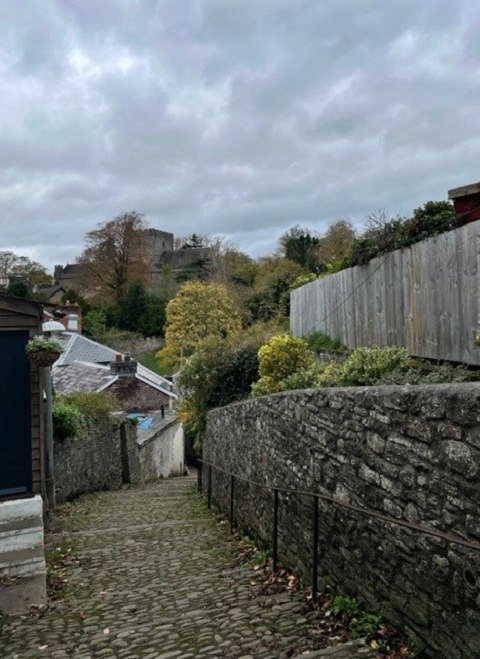
King Charles Steps – The name commemorates the visit of Charles I visit to Brecon in 1645 while attempting to raise support during the Civil War. Turn right at the bottom of the steps, walking a short distance before crossing over the road to arrive at a pretty, white pedestrian iron bridge over the river Honddu. This leads into Priory Groves.
Priory Groves and Brecon Cathedral – As you follow the footpath that curves upward, with the Cathedral wall on your left and the woods on your right, you will encounter what was Brecon’s first water supply. In the 1840s there was a serious cholera outbreak which unsurprisingly ended its use. Take the path to the left of this which leads you to the grounds of Brecon Cathedral. Walking through the graveyard, you can find a memorial to a French soldier who was kept prisoner here in 1797 after an invasion in Pembrokeshire. At the end of the path, pass through the lychgate then do have a look round the Cathedral Close which is under the arch to your left. Leaving the Close once more through the arch, turn to your left and carefully cross onto the pavement opposite the lychgate. Turn left, following the external wall of the Cathedral Close
(looking out for the splendid gargoyles!) and continue down the hill, taking the second turning on the right which brings you onto a one-way street called The Postern.
The Postern – There are several interesting landmarks in this old street including the old primary school and the old gaol. The Postern was also the site of the viaduct that carried the railway over the Honddu. Follow the road past the former gaol (and fire station) and down to where you can bear right and up the incline and into Castle Square where there is a large hotel.
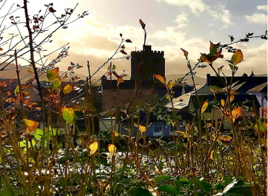
Castle Square – The Castle of Brecon Hotel was built in 1805 to satisfy British tourists who could no longer take the Grand Tour of Europe on account of Napoleon’s activities on the continent. Visiting ruins and mountains became popular pursuits. Behind the big gates opposite the hotel is the residence of the Bishop of Swansea and Brecon. Within its grounds is Ely Tower, famous in 1483 for imprisoning the Bishop of Ely, whose talks with the 3rd Duke of Buckingham initiated the downfall of Richard III and the victory of Henry VII in 1485.
Red Footpath – Having looked at Castle Square, return to the end of The Postern and cross the pedestrian ‘Castle Bridge’ over the Honddu. Having crossed the bridge, turn right onto Market Street which leads you to the junction where you will see the bridge over the Usk ahead of you to the right. The studs in the road at the traffic lights mark the site of the historic town gate. Cross over the two roads here to access the steps that go down from the bridge opposite Gate Gallery onto the ‘red footpath’ heading away from you along the river. The red footpath follows the route of the town walls, which were partially demolished by the town’s citizens to stave off a siege by Oliver Cromwell’s men in 1649. When you come to the end of the footpath you need to bear slightly right and then straight ahead, with the small car park on your right, ie the middle road, Canal Road, which will lead you to the theatre and the canal basin.
Theatr Brycheiniog and the Canal Basin – The original canal basin disappeared when the canal was taken over by the Great Western Railway in the 19th century, but in the 1990s it was re-established and is now a popular destination for visitors and locals alike. Beside the canal, Theatr Brycheiniog provides an important cultural and community venue for a wide range of events, including annual international festivals such as Brecon Jazz and Brecon Baroque. Walking in front of the theatre, follow the sloping path down onto the canal tow path which takes you under a little bridge and past Gas Works House. You will see a second bridge which you can access via the steep steps to the side to cross the canal or go under it and double back to cross the canal over this pedestrianised bridge onto Gas Works Lane.
Gas Works Lane and The Watton – The town’s gas supply was provided from here until the late 20th century and much money was spent in decontaminating the site to allow housing, namely Elliott Place, which is beside the canal beyond the Gas Work’s bridge. At the end of Gas Works Lane turn right onto The Watton. Notice some of the 24 trees planted to commemorate the 24th Regiment of Foot, (South Wales Borderers) famous for the defence of Rorke’s Drift in South Africa in 1879. Cross onto the other side of the Watton and head out of Brecon towards the barracks. Just before the Barracks take the turning on the left into Borderers Way.
The Barracks and Borderers Way – The Barracks were built in the 1840s in response to the increasing number of Victorian military campaigns. From here troops were dispatched to Merthyr Tydfil during unruly times, perhaps most notably during the 1831 Merthyr Uprising,
which involved Dic Penderyn amongst others. As you pass the Barracks wall, take the footpath that slopes up onto another footpath in front of Abbeyfield House. Turn left here heading back into Brecon, where you will see a small playground above the path on the right as well as Brecon Fire Station and a driving test centre, once the site of Brecon Railway Station which had three routes from the town. The footpath takes you down to some traffic lights where you can use the pedestrian crossings to pass the supermarket and return to the town centre carparks. As you do so, you will see The Markets Tavern to your left – so called because the Brecon Livestock Market was situated here until it was moved out of town to the western edge of Brecon in 1999.
Info
DISTANCE: 2 Miles
REFS: Grid: SO045286 POSTCODE: LD3 7BA
STARTING POINT: Visit Brecon office
TIME: 1- 1.5 hours
FACILITIES: There are toilets opposite Visit Brecon, in the cathedral and in Theatr Brycheiniog
Contact Details
- 01874 620860
- 07507 341733
- office@visitbrecon.org.uk
- 11 Lion Yard, Brecon, LD3 7BA